Copyright 2020 - 2021 irantour.tours all right reserved
Designed by Behsazanhost
Eight Thousand Years of History in Fars Province, Iran
Eight Thousand Years of History in Fars Province, Iran
By: D.T. Potts
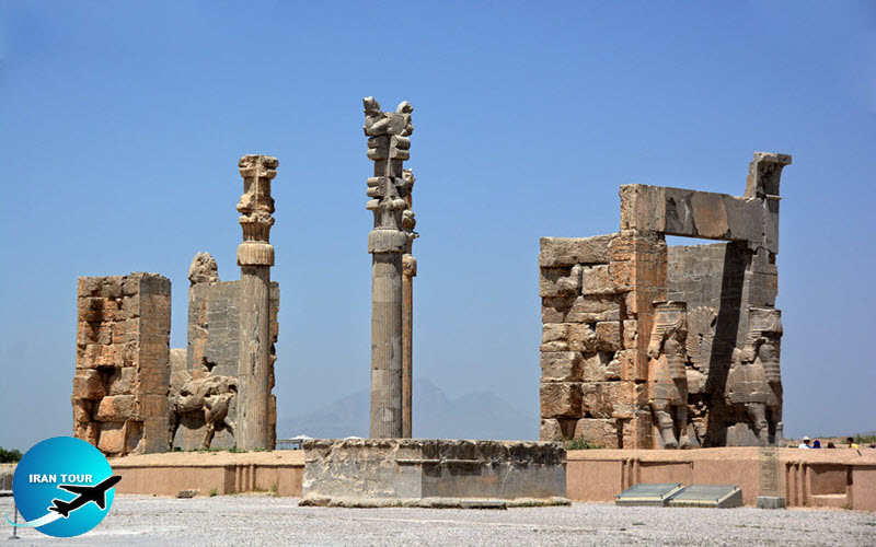
Fars province is quintessentially Persian. Its name is the modern version of ancient Parsa, the homeland, if not the place of origin of the Persians, one of the great powers of antiquity. From here, the Persian Empire ruled much of Western and Central Asia, receiving ambassadors and messengers at Persepolis. It was here that the Persian kings were buried, both in the mountain behind Persepolis and in the rock face of nearby Naqsh-e Rustam.
 |
But Fars was important long before the rise of the Persian Empire. Much earlier, prehistoric cultures had inhabited Neolithic and Chalcolithic sites in Fars like Tal-e Mushki, Tale Jarri, and Tal-e Bakun. In the Bronze Age, a major, walled settlement at Tal-e Malyan, known in Mesopotamian cuneiform sources as the city of Anshan, had dominated the area. And long after the Persians had faded into historical memory, Fars continued to be an important wellspring of Iranian cultural identity, for it was at Istakhr that Ardashir Papakan, founder of the Sasanian empire, was born, just a short distance from Persepolis and Naqsh-e Rustam. Fars continued to be an important province of this last, great pre-Islamic Iranian state, and indeed long after the Islamic conquest.
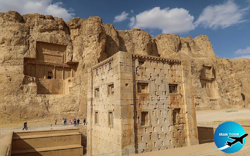 |
| Naqsh-e Rustam |
So Fars is not an Iranian province that has been neglected by historians or archaeologists. Indeed, European travelers began visiting the sites of Persepolis, Naqsh-e Rustam, and Pasargadae in the Renaissance, and when "modern" archaeological and epigraphic research began in the nineteenth century, the sites and monuments of Fars were among the first to be investigated. Yet when one looks more closely at a map of Fars, it becomes immediately obvious that the research conducted to date has been, to a large extent, concentrated on the Marv Dasht region, a large valley system northeast of the modern provincial capital of Shiraz. More work has been done in what we might call the "royal triangle" of territory bounded by Persepolis, Pasargadae, and Tal-e Malyan, than anywhere else in Fars. And yet Fars is a large province and there are great stretches of territory to the east, south, and west that have yet to be adequately investigated.
 |
Since 2002, this beautiful region of Iran has been the scene of a collaborative research project undertaken by the Iranian Cultural Heritage and Tourism Organization and the University of Sydney. When, in November of that year, a small group set out in a four-wheel-drive vehicle to follow the "Royal Road" from Shiraz to Susa, there was no denying that the Mamasani district attracted our attention for the number and diversity of archaeological sites in the region as well as for the high potential of the environment agriculturally speaking and its location astride one of the most important east-west routes in Iranian history Ancient and Modern Routes Through the Mamasani District of Fars. The series of mountain valleys and passes in the Mamasani district of western Fars lead directly to the province of Khuzestan in the southwestern comer of Iran. When Baron Clement de Bode rode through this area in January of 1841, he described it as "a tract almost wholly unknown to European geographers." It was through this region that the "Royal Road" ran, linking Persepolis and the Achaemenid winter capital of Susa. Two thousand years earlier, the same route linked Susa, the western capital of the Elamites-predecessors of the Persians in this region—with the eastern metropolis of Anshan, modern Tal-e Malyan. Nowadays, if one wishes to drive west from Shiraz by paved highway, it is necessary to first head south towards Kazerun, through a series of twisting mountain passes, before turning sharply to the northwest and regaining a westerly course.
|
Fars province is a unique workshop of sculpture and Achaemenian arts |
The paved road runs north and then west through the Mamasani district, an area inhabited by Lurs who were moved from Luristan, according to local informants, to serve in the army during the eighteenth century. In antiquity, however, the route van in a much more east-west fashion, over a series of high mountain passes that are today used as an alternative route to the much more heavily trafficked highway from Shiraz to Kazerun. Both routes, however, converge on the region of Nurabad before continuing on through a set of narrow passes and elongated valleys leading eventually to the Khuzestan border at a pass known as Pol-e Pirin.
The Mamasani district, located roughly one-third of the way along that route coming from Shiraz, comprises one of its most interesting segments. It lies in the highlands, approximately a three-hour drive along the paved highway west of Shiraz, in one of the most well-watered parts of the province, with six hundred millimeters average annual rainfall and springs bursting forth at numerous points along the base of the mountains at the edge of the plains. Major monuments in this region, including an Elamite rock relief at Kurangun, a post-Achaemenid, a rock-cut tomb at Da-u Dukhtar, a Sasanian stone tower at Dum-e Mil, and a Sasanian rock relief at Sarab-e Bahram, have been known for many years. In 1924 the German Iranologist Emst Herzfeld was shown a stamped brick from a mound near Kurangun known as Tol-e Spid. Although unable to read the inscription accurately, Herzfeld correctly identified it as Elamite and we now know that the text is a dedication by the Elamite king Shilhak-Inshushinak to the goddess Kilahshupir, which suggests that the brick probably came from a temple sacred to this deity.
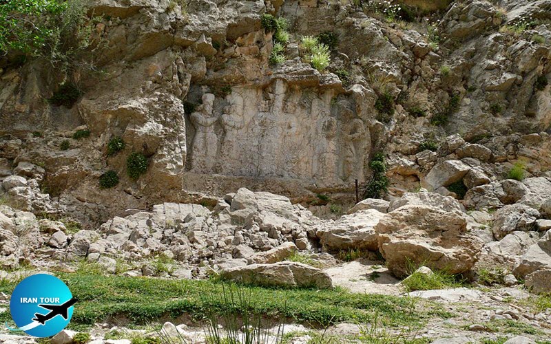 |
| Bas-relief of Sarab e Bahram |
The great explorer and scholar Sir Aurel Stein, too, traveled through this region in 1935 during a journey that was, to a great extent, devoted to retracing the route followed by Alexander the Great on his march from Susa to Persepolis. Finally, in the early 1950s, a Japanese expedition undertook test excavations at the site of Tappeh Suruan, known locally as Jin Jan, unearthing Achaemenid column bases that suggest the presence there of a royal pavilion or way-station along the Achaemenid Royal Road.
The Project
After returning to Tehran, we discussed the results of our survey with the Director of the Iranian Center of Archaeological Research, Dr. Massoud Azarnoush, and submitted a proposal to begin work in the Mamasani area as soon as possible. An agreement for one year of collaborative research was signed. By January 2003, we were back in Mamasani with a team comprised of about a dozen Iranian and Australian archaeologists, all living together in a rented house in Nurabad-e Mamasani, a busy market town of about forty-five thousand inhabitants.
Our strategy was threefold. We decided to begin a regional survey and excavation at two sites simultaneously, reasoning that Tol-e Nurabad and Tol-e Spid, two substantial mounds within our area providing tall exposed sections had the potential for good local pottery sequences. These could then be used to date the surface ceramics from the sites discovered during our survey. We discussed the fieldwork strategy together, devised a database for the recording of excavation, ceramic and small find data, and established three mini-teams to survey and excavate at Tol-e Nurabad and Tol-e Spid. Everything, from the topographic plans and section drawings to the sorting and description of ceramics, was done together. And before long, the project began to produce substantial results.
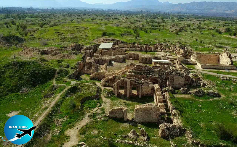 |
| Bishapour |
Excavations and surveys continued throughout January and February, but by the end of the season, we had not yet reached virgin soil at Tol-e Spid or Tol-e Nurabad. We returned in June and July, when we were able to complete the sounding at Tol-e Nurabad and make further progress at Tol-e Spid, and again in January, 2004, for a study season. The exposed sections of both Tol-e Nurabad and Tol-e Spid were ideal for limited excavation aimed at recovering stratified ceramics and carbon samples in as short a time as possible. With such valuable data and a fresh set of C" determinations, we would be able to date the bulk of the material recovered in the adjacent valleys on a survey.
 |
The mounds are approximately fifteen kilometers apart. Located in the Dasht-e Nurabad on the outskirts of the modern town of Nurabad-e Mamasani, Tol-e Nurabad stands about twenty-four meters above the plain and covers an area of around nine hectares. Plowing along the east and north sides of the mound has exposed a section approximately sixteen to eighteen meters high but several more meters of occupation extend below the present level of the plain around the site. Tol-e Spid, on the other hand, is now only about two hectares in extent, though cultivation and a modern settlement (abandoned only in the 1970s before the construction of a new village to the north of the site) have most certainly reduced it. When Herzfeld visited in 1924, it was undoubtedly more impressive. Bulldozing preparatory to the construction of a building in the recent past has exposed a section about twelve meters in height.
Our approach was to lay out a two-meter-wide and one-to-two-meter deep trench along the exposed, vertical face at each site. Although Spiderman would have found it difficult to cling to the sides of these mounds, we were fortunate in being able to call upon the services of professionals from the Sasanian site of Bishapur who erected scaffolding at each of our sites, enabling us to stand on the boards of the scaffold while excavating. Although unorthodox, this technique worked brilliantly and allowed us, in the course of two six-week seasons of excavation, to reach virgin soil at Tol-e Nurabad and to reach the level of the surrounding plain at Tol-e Spid. What the Sections Tell Us.
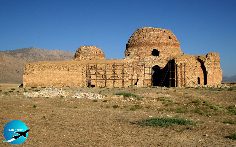 |
| The Sarvestan palace |
Although obviously limited in scope, these sections provided more than enough data for our purposes. Not only were stratigraphic and architectural features found in abundance walls, floors, hearths, and in the upper part of the Tol-e Nurabad section, part of a massive mudbrick building of Middle Elamite date (late-second millennium BCE)-but occupation seems to have been lengthy at both sites. We have both a very fine set of diagnostic ceramics and a plethora of carbon samples, from which we have already obtained approximately two dozen calibrated CW dates. Thus we have succeeded in excavating a well-dated sample of ceramics that provides most of the necessary comparanda for dating the pre-Islamic components at the sites in our survey area.
The earliest occupation at Tol-e Nurabad dates to about 6000 BCE. Several sherds show decorations that are characteristic of the assemblages recovered by Japanese archaeologists at Tale Mushki and Tal-e Jarri in the 1950s and 1960s, sites that hitherto represented the earliest Neolithic occupation of Fars province. But there are many pieces, both monochrome and bichrome painted wares, that have no parallels elsewhere, and with half a dozen architectural phases present in the lowest deposits at Tol-e Nurabad, it is clear that the Neolithic occupation of the site was substantial.
 |
| The Gur City |
Judging from our Ch dates, there is a gap of nearly one thousand years in the Neolithic occupation of Tole Nurabad, extending from the early-mid sixth to the early-fifth millennium BCE. It is difficult to know, however, if the entire settlement was abandoned at this time, or whether occupation may have moved to a different area of the mound. Regardless, shortly after Tol-e Nurabad was reoccupied, a material assemblage appeared that was both technically and stylistically very different from that of the Neolithic period. Sandy buff wares with black painted decoration recall types best known in the Marv Dasht at Tal-e Bakun Band Tal-e Gap. Along with a variety of typical geometric designs, we have several naturalistic representations of animals that are unparalleled. These include a depiction of an animal that resembles a donkey wearing a saddle blanket from level A18, which sits between strata that have yielded calibrated dates of 4940-4680 BCE (A19) and 4780-4490 BCE (A16). Unfortunately, we cannot corroborate this apparent iconographic representation of a domesticated donkey with faunal evidence, since the animal bones from our excavations have not yet been analyzed. But if we are correct in interpreting the animal like a donkey, and the dotted motif as a saddle blanket, then our sherd would represent by far the earliest evidence of domesticated donkey yet found in Iran.
From the Bakun-related horizon, we move to a period in which the ceramics resemble the so-called "Lapui" wares defined by William Sumner in the Marv Dasht region. This complex is known less from excavation (albeit present in the latest levels at Tal-e Bakun) than from surface finds at sites in the vicinity of the town of Lapui, which has long lacked a reliable stratigraphic context. With the excavations of Tol-e Nurabad and Tol-e Spid, it has now found one, for Lapui wares were recovered in abundance, both coarse and fine, at both sites. A radiocarbon date of 3910–3660 cal. BCE for the earliest Lapui phase yet excavated at Tol-e Spid provides an approximate date for the onset of this material, which leads, without interruption, into the mid-fourth millennium Banesh Complex, as defined at Tal-e Malyan.
 |
| Gur e Dokhtar |
The Banesh period at Tal-e Malyan was characterized by the appearance of imported shapes-even if locally manufactured-from the west. These included bevelerim bowls and low-sided trays, both of which are well-known in Mesopotamia on sites of the Uruk period (particularly the Late Uruk era) and on contemporary sites in Khuzestan such as Susa, Tepe Jaffarabad, and Tal-e Ghazir. Just what the distribution of these types in the Iranian highlands signifies is difficult to say. It is highly unlikely that they reflect colonization or extensive trade relations with Mesopotamian communities, as many scholars have suggested for sites located along the Euphrates in southern Turkey and Syria. Moreover, bevel rim bowls in small quantities have been found at a number of other sites on the Iranian Plateau (e.g., Godin Tepe, Tepe Yahya, Tal-i Iblis, Tepe Sialk, Tepe Ozbaki, Tepe Ghabristan, and Arisman), from Luristan to Baluchistan, and even as far as Miri Qalat in Pakistani Makran.
During the third and early second millennia BCE, the Mamasani valleys were certainly within the orbit of Elam and its highland component, Anshan. By 2500 BCE, Elam and its neighbors-Awan, Shimashki, Uru'a, Mishime, Marhashi, and Anshan-began to appear in Mesopotamian sources as, in the main, hostile elements in the east. Successive Mesopotamian states-Early Dynastic Lagash, the Old Akkadian Empire, the Third Dynasty of Ur, the First Dynasty of Babylon, the Kingdom of Eshnunna, the Kassites, and the Assyrians--had ongoing relations with the peoples of highland Iran that alternated between brutal conquests and interdynastic marriages. With a lowland component in Khuzestan, centered on Susa, a highland one in Fars, centered on Anshan (Tal-e Malyan), and a port on the Persian Gulf at Liyan (Tol-e Peytul, near modern Bushehr), the Elamites occupied the southwestern corner of what is today Iran. Mamasani lies astride the main east-west routes between Anshan and Susa and is also the point where this route is met by the road northwards from Liyan, on the Persian Gulf. It is therefore not surprising that the district should boast a major Elamite rock relief, at Kurangun, or a settlement at Tol-e Spid, at which an inscribed Elamite brick from the reign of ShilhakInshushinak (ca. 1150 BCE) was found, recording the dedication of a temple to the goddess Kilahshupir. Both Tol-e Spid and Tol-e Nurabad have yielded a wealth of painted pottery, some with parallels at Tal-e Malyan, but most without known parallels elsewhere, which certainly reflects local traditions in this part of Iran of which little is as yet known.
 |
| Shapour Cave |
The end of the second millennium and early first millennium BCE appears to be something of a blank in the Mamasani area. This means that we are in no position to speculate on the rise of the Achaemenid empire—the first of the great Iranian empires-which came to power in the sixth century BCE. Certainly, there are Achaemenid ceramic types present at both Tol-e Spid and Tol-e Nurabad, but perhaps more interesting are the sites of Jinjan (Tappeh Survan), about 4.7 kilometers southwest of Tol-e Spid, where Achaemenid column bases in Persepolitan style have been known since Ernst Herzfeld first saw them in April 1924. A rapid investigation of the site by a Japanese team in the 1950s confirmed the existence of a building there, and it is likely that this represents a way-station or small palace on the Royal Road from Persepolis to Susa. At Tappeh Pahnu, another site visited during our survey, which lies about seventeen kilometers northwest of Jinjan, farmers have uncovered a number of simple, possibly unfinished stone column bases, which also appear to be either Achaemenid or possibly later.
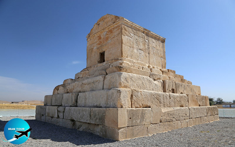
A post-Achaemenid date is possible, particularly given the presence of Parthian ceramic types at both Tol-e Spid and Tol-e Nurabad. But the most impressive monument of the post-Achaemenid period in the area is undoubtedly the rock-cut tomb at Da-u Dokhtar, which has been known since Herzfeld's initial visit to the region. Intriguingly, because he believed that the inscribed brick in Elamite from Tol-e Spid meant that the Mamasani area was part of Anshan, Herzfeld suggested that the tomb at Da-u Dokhtar might have been that of one of Cyrus the Great's ancestors. In the Cyrus Cylinder from Babylon, Cyrus is called "son of Kambuziya (Cambyses), great king, king of Anshan, grandson of Kurash (Cyrus), great king, king of Anshan, great-grandson of Shishpish (Teispes), great king, king of Anshan." Herzfeld reasoned that Da-u Dokhtar might well have been the tomb of one of these ancient kings of Anshan. Attractive as this theory is, David Stronach and Hubertus von Gall have shown that the tomb's architectural elements make it more likely that it post-dates the Achaemenid period rather than pre-dates it. That being the case, it may well have been cut for a local representative of the frataraka dynasty, a dynasty that reigned in Fars during the period following Alexander the Great's conquest of the Persian Empire. Later Sasanian occupation in the region is well-represented by the major rock relief of Sarab-e Bahram, first noted by Baron within the city limits of Nurabad-e Mamasani), believed by early Islamic historians to have been founded by Shapur I, and a number of mounds within the survey area.
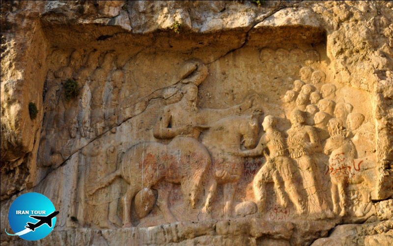 |
| Darab Bas-relief |
More Than Scratching the Surface
The soundings at Tol-e Spid and Tol-e Nurabad have certainly done more than scratch the surface, but there is obviously much more that can be done at each site in order to expose greater areas of architecture and domestic settlement. After spending two seasons digging from the boards stretched across a scaffold, it would be nice to excavate on terra firma and gain a better horizontal exposure at each site. In addition, the survey has certainly pointed to some promising sites where small soundings could potentially answer a number of questions about specific periods in the region's past. An agreement for a further five years of collaborative research, beginning in January of 2006, has recently been signed by the Iranian Cultural Heritage and Tourism Organization and the University of Sydney. Like de Bode, who was impressed by the natural beauty of the Mamasani district, Herzfeld and Stein, who were impressed by the archaeological richness of the area, and many others who have driven along the road through Fahliyan, we eagerly anticipate further work in this exceptional corner of Fars province.
- Details
- Category: IRAN Blog