Copyright 2020 - 2021 irantour.tours all right reserved
Designed by Behsazanhost
How did the country become known as 'Iran?
How did the country become known as 'Iran?
The word Iran was known as "Arya' in ancient Tram and Perdin'in Old Persian language and is! derived from ancient Arya
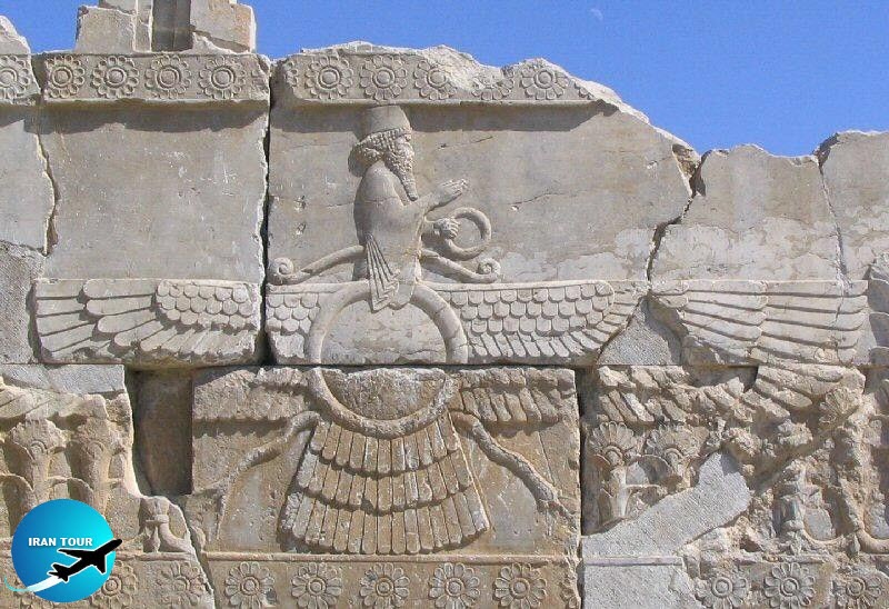 |
Aryana' or 'Arya! means freedom and in its collective form means the land of freedom. From another aspect 'Iran means the Land of Aryans. Many centuries before the birth of Islam the country was called 'Iran'or "Iranskar. Of course from the 6th century B.C. until 1935 the country was known as 'Persia" by the world. In that year Reza Shah Pahlavi formally requested the League of Nations or the newly established United Nations to use the word 'Iran' instead of Persia on the international level. However since many European scholars and travelers had known the country as Pers this term is mentioned in western classic books, but 'Iran' is used by politicians. Meanwhile in Iranian cultural-artistic exhibitions bed been launched in Europe such as "Seven Thousand Years of Iranian Art' or 'The Forgotten Empire' Iran is mentioned as Persia.
 |
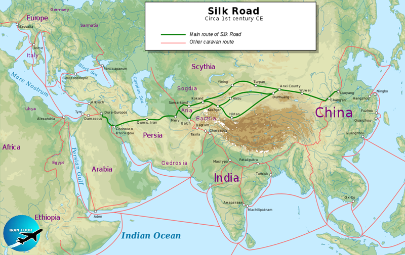 |
The Geographical situation of Iran
Iran is located southwest of the Asian Continent, From the north the country borders the Caucasus and Caspian Sea (Mazandaran Sea) and Central Asin from the east it borders with Afghanistan and Pakistan from the south with the Persian Gulf and Sea of Oman, and from the west, it is bounded by Iraq and Turkey present Iran is part of a bigger mountainous plateau which incorporated several seas, lakes, and plains including the Caspian Sea at the north, the Jeyhoon and Seyhoon plains, the steppes at northeast, the Koora (Koorosh) Plain at the northwest, the Punjab Valley at the southeast, Sea of Oman and the Persian Gulf at south and Mesopotamia region between Tigris and Euphrates at west. In fact, the former bigger Iranian plateau covered an area of 2,600,000 sq. km out of which only 1,648,000 sq. km belongs to present Iran. Iran is a giant parallelogram fallen between the Persian Gulf and Sea of Oman at the south and the Caspian Sea at the north and has served as a bridge and corridor between Central Asia and Western Asia. Its bigger diameter stretches from Ararat Mountain at the north to
Learn more about Iran:
Iran History
Nature of Iran
-Iran Deserts
-Iran forests
-Natural Landscapes
Art Of Iran
Iranian Cuisine
Iranian Calendar or Chronology
Iran Religion
- Details
- Category: IRAN Blog